Geosciences for climate monitoring and risk management
We develop meteorological, climatic, hydrological, maritime, and geotechnical observation solutions to accurately monitor, analyze, and anticipate environmental phenomena.
We provide reliable technical information that supports operational and strategic decisions in critical environments.
The integration of science, technology, and specialized analysis can strengthen your climate and operational management.
View current conditions, trends, and warning signs in different parts of the country. Strategic information to anticipate threats and optimize operational response.
Specialized services in monitoring, analysis, and prediction
At Canal Clima, we integrate observation, analysis, and technical operations to transform geoscientific information into reliable inputs for strategic decision-making. Each service is designed according to standards of traceability, accuracy, and operational continuity.
Continuous monitoring and timely alerts to anticipate and mitigate climate risks.
Specialized service in environmental monitoring to prevent risks that could affect critical infrastructure, industrial processes, and the safety of people and the environment.
Operates 24/7 from a Control Center with expert professionals, integrating measuring instruments, satellite information, and data science for early detection and timely decisions.
Technical capabilities
Weather forecasts based on atmospheric modeling.
Real-time monitoring using OUTDOOR/INDOOR stations.
Integration of satellite data, radar, and government sources.
Detection of storms and lightning strikes.
Weather, climate, hydrological, maritime, and geotechnical monitoring.
Remote observation using remote sensing cameras.
Applications
Designed for climate-sensitive sectors that need to ensure operational continuity, protect assets, and optimize their response capabilities through systems that integrate continuous monitoring, predictive analytics, and real-time information to anticipate threats.
Key benefits
Reduction of incidents and operational losses.
Greater security for personnel and infrastructure.
Regulatory compliance and information traceability.
Digital integration with proprietary platforms and systems.
Reliability and continuity in geoscientific data capture.
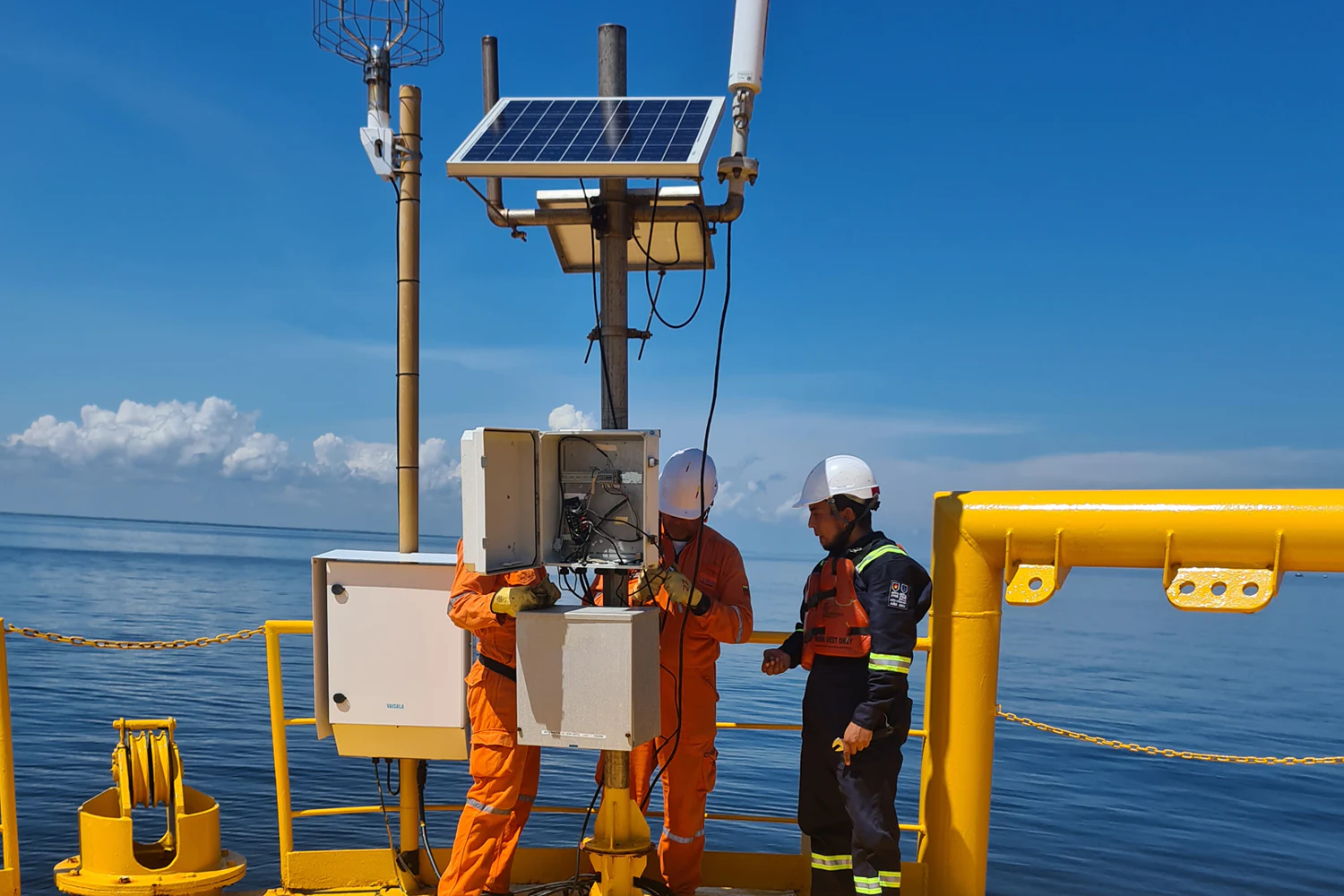
Comprehensive service aimed at ensuring the operability, accuracy, and traceability of meteorological, hydrological, maritime, and geotechnical monitoring networks.
A continuous flow of data and optimal performance of field equipment are possible with robust technical management.
Technical capabilities
Installation of specialized measuring stations and instruments according to technical requirements and site conditions.
Preventive and corrective maintenance to ensure optimal system performance.
Network operation and administration under quality and operational continuity protocols.
Technical verification and performance monitoring to ensure data integrity.
Technical and operational value
Each network is managed according to WMO best practices, ensuring optimal system performance and the integrity of the information collected.
The service is tailored to projects in energy, oil & gas, infrastructure, agriculture, and environmental management.
Key benefits
Maximum operational availability of monitoring systems.
Reduction of failures and loss of information.
Calibrated equipment and technically verified data.
Data transformed into knowledge for strategic decisions
Specialized service in the processing, modeling, and technical evaluation of geoscience information, aimed at strengthening planning, risk management, and strategic decision-making in productive and territorial sectors.
Technical capabilities
Analysis of thresholds and climatological data to identify risks and trends.
Statistical evaluation and validation of data from internal or external networks.
Implementation of data quality management systems and equipment calibration.
Development of predictive models and climate scenarios for planning and adaptation.
We integrate scientific methodologies, multivariate analysis, and decision support tools to deliver quantifiable, traceable results tailored to each client’s operational context.
Key benefits
Validated and scientifically supported information.
Early identification of environmental and operational risks.
Improved efficiency in planning and regulatory compliance.
Technical support and knowledge transfer to the client.
Scientific rigor, technological support, and proven experience
From energy and oil to agriculture, mining, and public management, we provide high-value weather and climate information for the planning, safety, and sustainability of operations.
Each sector faces different challenges, but they all share the same goal: turning data into decisions that generate value and protection.
Public and Government Management
Public entities require reliable information to prevent disasters and plan land use.
Canal Clima enhances the formulation of climate adaptation policies and strategies, facilitating decision-making through early warning systems and risk maps, supported by digital solutions for monitoring and efficient event management.
The weather has a direct impact on the safety and scheduling of outdoor activities.
Canal Clima provides localized and real-time information for the management of sporting and recreational events, through digital platforms that allow anticipating storm conditions or heavy rain under accurate forecasts.
The hydrocarbon sector faces constant risks associated with climate and the environment.
Canal Clima offers technical support for exploration, transportation, storage, and distribution, ensuring operational continuity and safety through forecasting, environmental monitoring, early warnings, and connectivity of climate control systems throughout the operational process.
Responsible mining depends on accurate knowledge of the environment.
Canal Clima offers integrated solutions for climate, geotechnical and environmental management, aimed at ensuring operational safety through risk assessment, monitoring of ground stability and centralized access to relevant information in real time.
The energy sector requires precision, continuity, and a predictive understanding of the climate.
At Canal Clima, we enhance decision-making in energy generation and operation through technology and analysis of hydrometeorological and climatic variables (solar radiation, wind potential, flow rate, among others), supported by digital platforms that allow access to essential data for efficient management.
Civil engineering projects require planning based on data and knowledge of the climate environment.
Canal Clima supports the development of resilient infrastructure through meteorological and geotechnical studies, supported by digital solutions that allow the monitoring of critical variables in construction processes for safe and efficient operational management.
At Canal Clima, we strengthen precision agriculture through information and technology that allows us to anticipate pests, optimize irrigation and improve harvests, through detailed monitoring of environmental variables (humidity, temperature, precipitation, among others) and forecasting of extreme events, supported by digital solutions for monitoring and alerting of conditions in the field.
Technology that transforms geoscience data into smart decisions
We develop digital platforms that integrate, visualize, and analyze meteorological, climatic, hydrological, maritime, and geotechnical data at your fingertips. Our tools connect climate science with operational management, facilitating safer and more efficient decisions in strategic sectors.
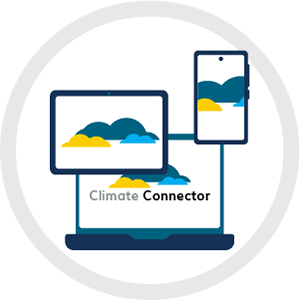
Climate Connector
Web platform for monitoring and analyzing meteorological, climatic, hydrological, maritime, geotechnical, and satellite data in real time. Centralizes information to support accurate and proactive operational decisions.
Mobile application (Android and iOS) for consulting historical data, real-time information, and forecasts of meteorological, climatic, hydrological, maritime, and geotechnical variables.
Integration interface that allows geoscientific, satellite, and operational data to be connected to external platforms in a secure and standardized manner.
We integrate science, technology, and continuous operation into high-precision climate solutions.
Monthly alerts, backed by 24/7 monitoring.
Technical expertise applied in geosciences and climate management.
Operational hydrometeorological stations in Colombia and the region.
Projects carried out in strategic sectors in Latin America.
Stories that make a real impact
Projects that strengthen security, operation, and sustainability
Canal Clima's success stories demonstrate how our monitoring systems, digital platforms, and geoscientific analysis support critical decisions in strategic sectors.
Each project reflects reliable solutions that reduce risks, optimize operations, and deliver sustainable value.
CENIT
Weather monitoring for onshore hydrocarbon transport infrastructure
Implementation and operation of a comprehensive system with more than 90 stations, advanced telemetry, and 24/7 technical support to protect more than 7,000 km of oil pipelines.
Climate, hydrological and geotechnical monitoring for gas pipeline infrastructure in Peru
Comprehensive system for over 700 km of gas pipeline, designed to anticipate landslides, flash floods, and events associated with the El Niño and La Niña phenomena.
Each Canal Clima implementation demonstrates how climate science and technology strengthen the security, efficiency, and sustainability of the sectors that drive development in Colombia and Latin America.
Learn how we can transform climate data into strategic decisions for your operation.